October 7 Trail Work Day – Surveyor’s Ridge Reroute

Surveyor's Ridge TrailThe Surveyor’s Ridge Reroute Continues!

A segment of the Surveyor’s Ridge Trail #688 will be impacted by the City of The Dalles Watershed Pipeline replacement project.

We re working on a re-route of the Surveyor’s Ridge trail where it follows the pipeline to maintain a semi-primitive trail experience. The reroute also improves interconnectivity of trails in the vicinity by connecting with the Super Connector and will provide a short loop for beginner riders who want a shorter trail experience than Surveyors Ridge. READ MORE about the Surveyor’s Ridge Reroute Project and check out project map.

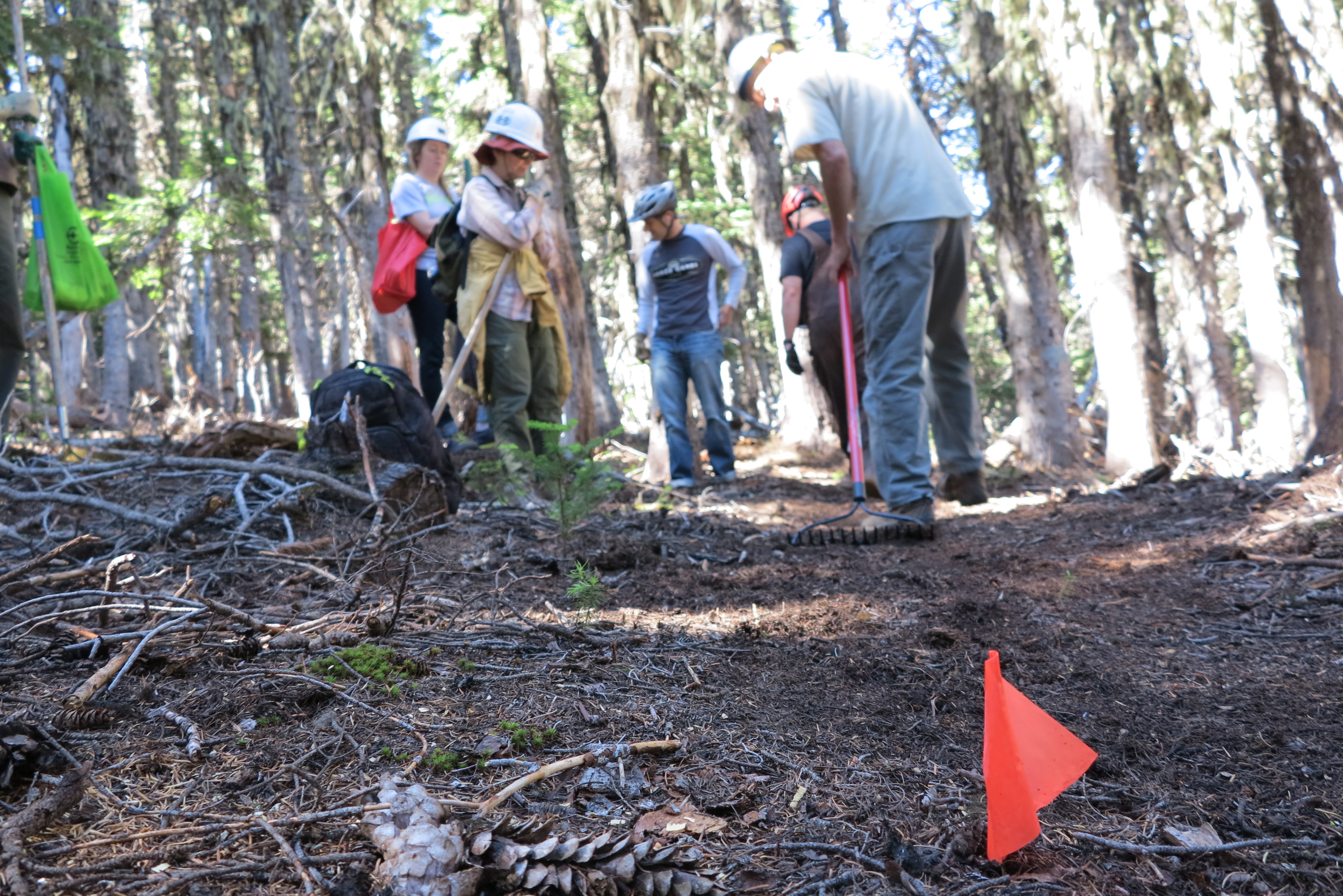
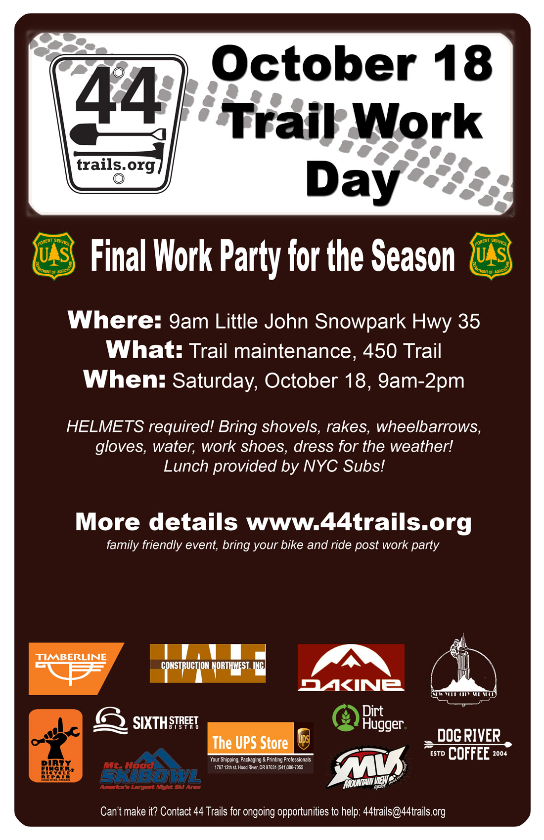
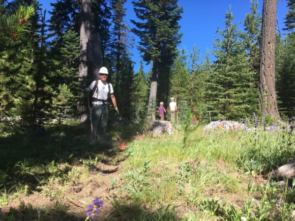
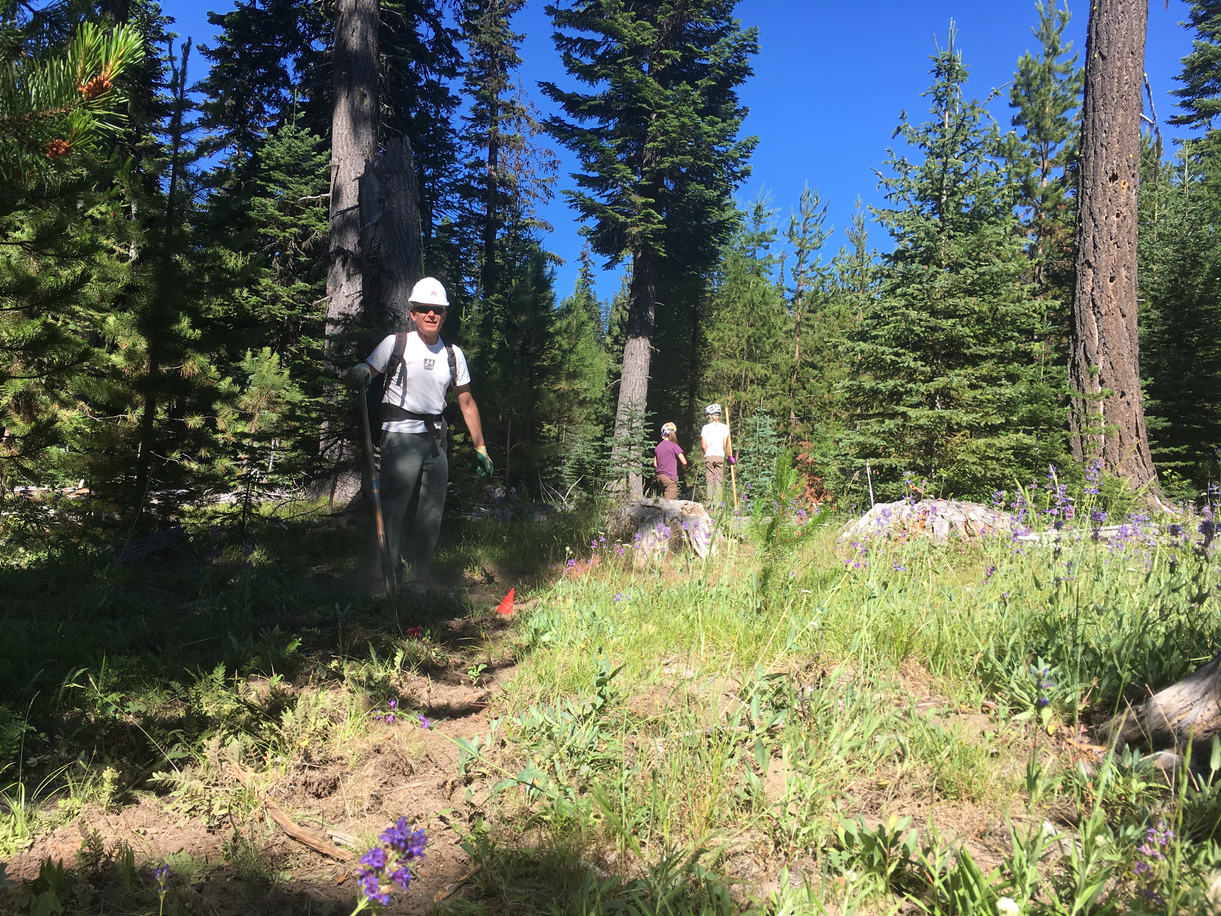
Trail Work Day – Surveyor’s Ridge Reroute Project

REQUIRE EQUIPMENT:
Hardhats (bike helmets ok), long pants, work gloves and work boots, water. 

WHEN: 
Saturday, October 7, 2017 @ 9am – 2pm (plenty of time for a post-work-project ride)
Meet 9am @ Little John SnoPark on Highway 35
We’ll have coffee thanks to Dog River Coffee in HR and sign-in at the SnoPark and then move up to the work site as a group. Lunch will be provided by NY City Subs in Hood River.

PROJECT:
Handbuilt singletrack on Surveyor’s ridge re-route. We will be doing rough in and route trimming/clearing.

TOOLS:
Surveyor's Ridge
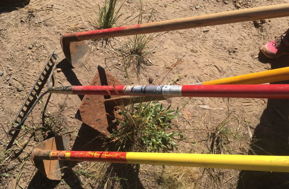
Helmet/hardhat (bike helmets ok), long pants, gloves, and work boots required.
Hand tools only – Flat Shovels, McCleods,Metal Rakes (NO chainsaws please).


Surveyor's Ridge Trail Reroute

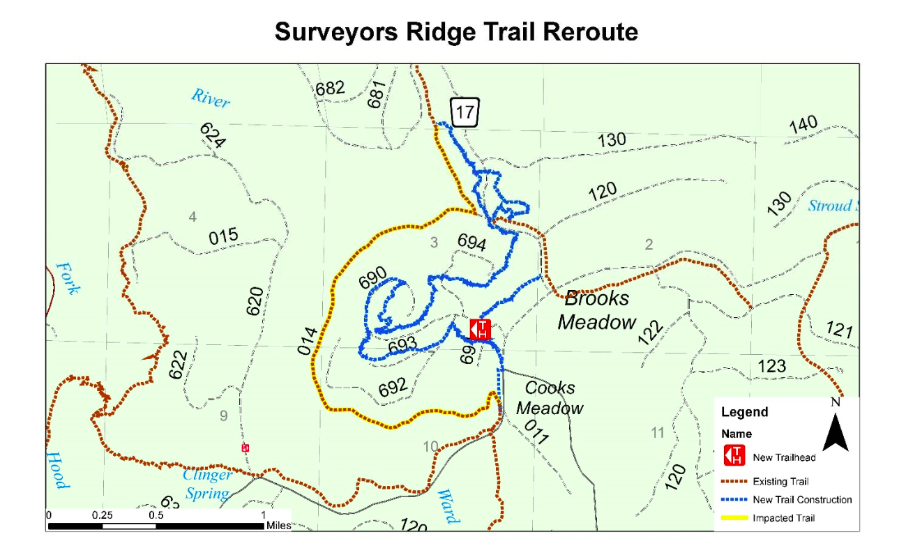
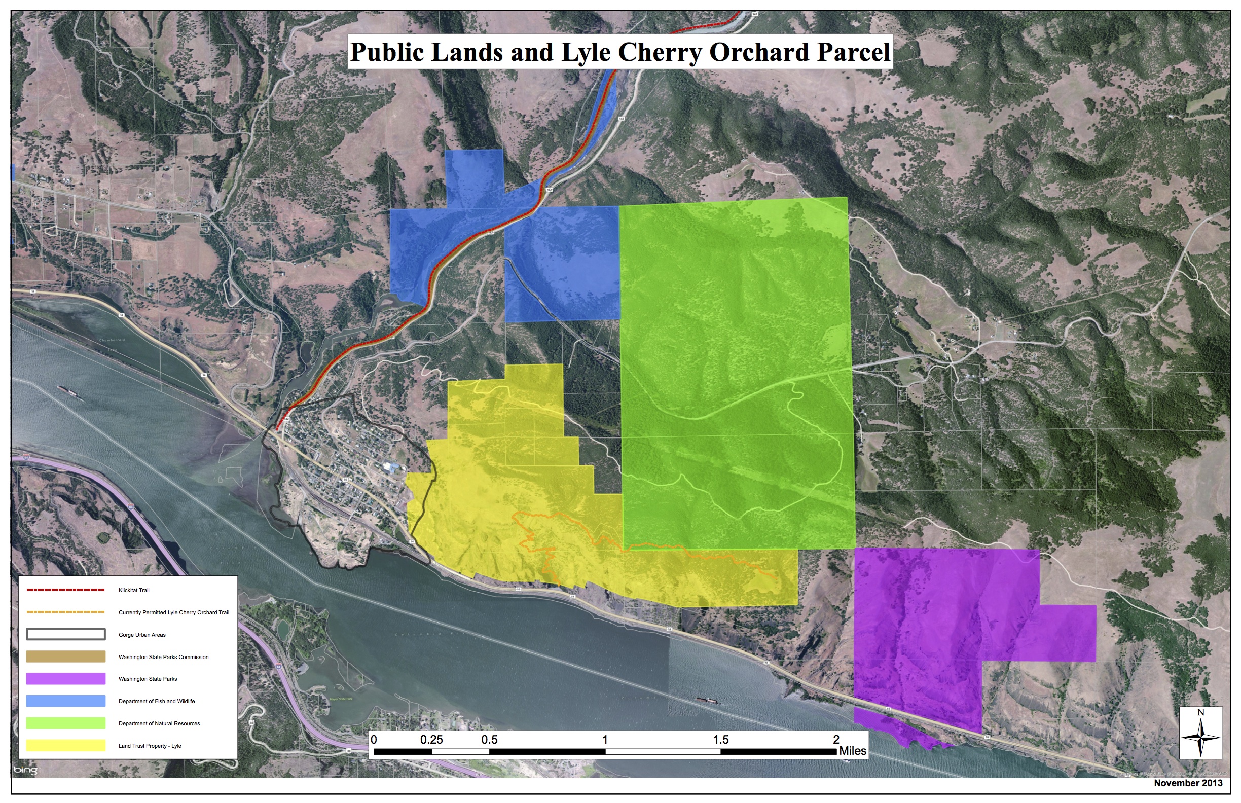
Here is the map showing the approximate route of the Surveyor’s Ridge trail project. The existing trail (yellow) will be disrupted by the new pipeline – the new route (blue) shows the tentative routes to connect with the SuperConnector (brown) near the 17 Road.


Aug 20 Trail Work Day

August 20 Cooks Meadow Extension Hand-Built Singletrack
mt hood single track

Saturday, Aug 20 is our is our next full-scale trail work day of the season, and we will be working on the Cooks Meadow Extension Trail.

We made great progress in July and look forward to more good work on Saturday Aug 20. We need you, of course, plus Metal Rakes, a few McLeods and some flat shovels

WHEN: 
Saturday Aug 20, 2016 @ 9am – 2pm
Meet 9am @ Little John SnoPark on Highway 35
We’ll have coffee thanks to Dog River Coffee in HR and sign-in at the SnoPark and then move up to the work site as a group.

PROJECT:
Hand-Built tread work on Cooks Meadow Extension trail.

TOOLS:
Helmet/hardhat REQUIRED!!! (bike helmets ok), long pants gloves, and work boots required.
Hand tools – METAL RAKES ARE TOOL OF CHOICE

We’ll probably work ’til about 2pm and will have sandwiches from the awesome NYC City Sub Shop in Hood River for the crew.

Although the trail is arguably just roughed in, it can be ridden, especially the lower half. In fact, riding it will help establish it. So, bring your bike for an aprés trail work pedal!

Want to know more about the trail? check out the map

Polallie Cooper Timber Sale

Polallie CooperIn case you were not aware, the Forest Service is preparing a longterm timber / fuels reduction plan, aka a Timber Sale, for what is called the Polallie Cooper area on the east side of Mt Hood.

The Environmental Assessment (EA) for the Polallie-Cooper Timber Sale was released recently and the public comment period ends on February 25, 2016.

You can download and view a pdf copy of the Polallie-Cooper EA here. It’s a long (300+page) document, but one of the critical concerns to 44 Trails is the USFS proposal to move ahead with a 55-foot buffer on either side of trails that fall within the timber sale. This means cutting to within 55 feet of either side of existing trails.

44 Trails Association, among other groups involved in a collaborative process before the EA was completed, suggested a 100-foot buffer (on each side) be used. The idea behind our 100-foot per side recommendation is to preserve the quality of the trail user experience as much as possible. The trail user experience being based on forest quality and trail/tread quality, both of which, we believe, are directly related to forest canopy where more forest canopy equals a better experience and better tread quality/durability.

Of the trails impacted by the proposal, the Dog River Trail (#675) is the highest profile within the mountain bike community. Not only, could the proposal result in cutting within 55 feet of the trail, it will surely impact the trail with extended closures while the work is being done.

There is a public meeting on Weds., Feb. 10 from 5 to 7 pm at the Hood River fire station in next to the pool in Hood River. We hope to see you there.

This is an important opportunity to let the Hood River Ranger District hear your opinion of the proposal.

You can also submit written comments to the Forest Service, by February 25th, your opinion could help preserve the riding experience on the Dog River Trail and beyond into the future.

To comment or to learn more
contact: Casey Gatz – Interdisciplinary Team Leader
(541) 352-1255 cgatz@fs.fed.us
www.fs.usda.gov/projects/ mthood/landmanagement/projects

Download Polallie Cooper Timber Sale Environmental Assessment


November 21 Trail Work CANCELLED

We are CANCELLING the November 21 work day due to snow. The 44 road is a mess of frozen snow and slush.

We will look toward December 5 as the next possible work day, weather permitting and will keep you posted here, on FB and via our e-mail list.

Thanks for your support!

October 18 Work Party

October 18 work partyThe final work party of the season is almost here. This round, we’ll be working on the 450 Trail doing some repair and enhancement projects. As usual we’ll meet down at Little John Snopark at 9am.

Please bring rakes, shovels, McLouds, wheelbarrows, etc. We’ll have Timberline there with at least one power toter, too.

Shoot us an e-mail with any questions. 44trails (at) 44trails.org.

See ya Saturday Oct 18!


Summer Trail Work Schedule

Here’s the official summer work poster. First session on June 14 will most likely be used to armor and bank corners on the new Super Connector. Specific event details for June 14 event will come together and be announced here by early June.

Saver a date or two on your calendar and join us to keep the 44 Trails zone buffed out!

44 Trails Trail Work

44 Trails Trail Work

Avalanche Safety Presentation

The snow gods may be slow in delivering the goods this year, but it’s never too late (or too early) to learn about avalanche safety. Ranger Jim Thornton is offering a free avalanche safety briefing on January 24, 2014 at Dog River Coffee. Check it out.

avy_awareness

Proposed Lyle Area Trails

Lyle draft map of areaThere’s an open house hosted by the Friends of the Columbia Gorge regarding the idea for a community trail system out of Lyle, Washington on Dec. 11 at 5 pm at the Lyle Activity Center. The idea is part of the Towns to Trails vision put forward by Friends of the Columbia Gorge.

Here are few details:

What is the goal of the project?
The goal of the project as defined by the community planning team is to: “Develop a plan for a non-motorized multiple-use trail system that is respectful of the community, land-owners, and land managers.”

Who is leading this trail planning process?
This effort is a community-led effort with community members, landowners and other stakeholders attending and participating in planning discussions. The National Park Service’s Rivers, Trails and Conservation Assistance Program is providing facilitation and project management assistance. The Friends of the Columbia Gorge Land Trust, Washington Department of Natural Resources, and the Washington Department of Fish & Wildlife are participating in the effort as landowners. Other organizations participating in meetings (but not necessarily in favor of the project) include the Lyle Fire Department, Klickitat Healthy People Alliance, private business owners, adjacent landowners, and residents of the area.

Read more info: Lyle Communty Trail System FAQs (PDF)

Check out a map of the area: Lyle Trail Draft Map of Area (PDF)