44 Trails Meets Forest Leadership

Mount Hood National Forest

Forest Leadership Team

44 Trails Association participated in a congressional review of the Mt Hood National Forest with the USFS Forest Leadership Team for the Mt. Hood National Forest on May 30.

Our favorite corner of the Mt Hood National Forest (the 44 zone) plays an important role in the forest as it holds the watershed for The Dalles as well as the Dog River Pipeline, a vital component of the watershed. Additionally, ongoing fire mitigation thinning work, upcoming Dog River Pipeline upgrades and, of course, the importance of recreation were combined for a tour of the forest for congressional representatives, county representatives from Hood River and Wasco and the full regional Forest Leadership Team (FLT).

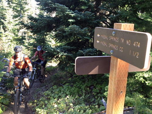
44 Trails was able to share stats on our ongoing work efforts to maintain, restore and enhance the multi-use trails accessible from FR 44. The FLT was very appreciative and supportive of our efforts, so we look forward to continued cooperation with the Barlow and Mt Hood districts to further our mission of trail maintenance and expansion!

Trail Work Schedule

Sweet new trail signs!

Sweet new trail signs!

The dirt is top notch in the Gorge right now and the riding season for Mount Hood’s 44 Trails area is fast approaching. As of May 8, there is still some lingering snow and plenty of downed timber on the upper trails accessible from Forest Road 44. Typically, the bulk of the system will be cleared and ready to enjoy come Memorial Day Weekend.

In the meantime, we’ve set a schedule for summer trail work parties to keep our mission of maintenance and expansion moving forward. Please mark these dates in your calendars and join us when you can. We strive to work for 4-5 hours in the morning and then enjoy an afternoon trail session, so you don’t have to give up a day of riding! More details about each event will be provided as the date nears and as we evaluate trail needs:

June 14 – Celebrate National Trails Day with a 44Trails work party – (Nat. Trails Day is actually June 7, but our event will be on June 14)

July 26 -Mid summer work day to armor and maintain high-traffic areas

October 4 – TBA Special Event – riding related event to thank everyone for all their support

October 18 – Final trail day before winter transforms the forest floor

Although random acts of kindness in helping to clear the trails is appreciated, all significant clearing and trail work needs to be organized through the USFS to maintain trail standards. The process on 44 Trails is different from that in Post Canyon or Sandy Ridge, and we need your help adhering to this policy. We have a great relationship with the Mt. Hood and Barlow Ranger Districts, and we aim to keep it that way. If you have time and energy to help with trail work, please reach out to us. We have ongoing opportunities to help clear and maintain the trails outside of our scheduled events. Give us a shout and we can connect you with the details.

Super Connector Work Day Sept 14

Kneabl Springs Trail

Knebal Springs Mt Hood Hood National Forest

The 44 Trails zone was spared any fire damage from the recent Government Flats wildfire, and the riding is as good as it gets right now. Recent rains have knocked back the dust for a primo riding experience.

If it’s not on your calendar already, Saturday September 14th is our next, and hopefully final, Super Connector trail work day. Here’s the beta:

Where: Meet 9am Little John SnoPark on Highway 35

What: Final tread development to link Knebal and Surveyors -bring hand tools if you’ve got ’em – shovels, rakes, McLeods

Required: Helmets and long pants (bike helmets are a-ok), don’t forget gloves and clothing to keep you happy rain or shine – bring water too.

Time: We expect to work til 12 or 1, so you can still enjoy a good ride post work day

New York City Subs is kicking in lunch food, Dog River Coffee is kicking in morning coffee. There’ll also a be a sweet little swag raffle to help say thanks for your work!

44 Trails Area is Open for Riding!

Updated fire closure map

Updated fire closure map

The 44 Trails zone on the Mount Hood National Forest is open for riding!

Thanks to favorable weather conditions and the efforts of wildland fire crews, the 44 zone is accessible again.

The 17 road remains closed, but 8-Mile, Knebal Springs and the rest of the 44 Trails are open for riding. Ranger Thornton was up in the area on Thursday and said there is moisture in the dirt and the trails are in great shape.

Here is the latest closure info:

Fire Closure Still in Place

It looks like the USFS is going to maintain its existing fire closure for the foreseeable future. Sorry, but the 44 Trails area will be closed for the Labor Day holiday weekend.

The wet and cooler weather has definitely aided in the management and suppression of the Government Flats fire that lead to the road and trail closures but there is still work to be done and fire hazard in the area. The burn has been spotty in areas, which makes mop up efforts a bit more difficult to monitor assess.

What we need is a big multi-day rain cycle. In the mean time, check out rides on Gunsight ridge and the Boulder Lake zone. You can keep tabs on the fire updates at www.inciweb.org/incident/3662/

Latest Fire Closure Update for 44 Trails

USFS 44 Trails closure map

USFS 44 Trails closure map

West winds have cleared the smoke from the Hood River Valley, but the 44 Trails area is still effected by closures. As far as we know, the trails themselves have not been consumed by fire, but there will be active fire suppression efforts in the area and the threat of fire growth, so the USFS is going to keep the zone east and north of the 44 road off limits for a while.

Here’s the latest:

The Mt. Hood National Forest has announced the following closures:

The following campgrounds are closed: Knebal Springs, Lower Eight Mile Crossing, Eight Mile, and Gibson Prairie. Five Mile Lookout is also closed.

The following major trails are closed:

  • Surveyors Ridge # 688 both south and north trailheads
  • Eightmile Loop #496
  • Knebal Springs # 474
  • Bottle Prairie #455
  • North-South #451
  • Oak Ridge #688A
  • Dog River #675
  • Zig Zag #678

Forest Roads 17, 1720, 4430 and all their associated spur roads are closed along with and all other National Forest System Roads and minor trails within the closure area depicted on a map posted on InciWeb.org at http://inciweb.org/incident/maps/3662/

Fire Closure Update for 44 Trails Area

fire map 8/23 update

fire map 8/22 update

Growth of the Government Flats Fire Complex on August 21 is leading to more road/area closures related to the 44 Trails area. Although the decision is not yet final, today’s morning meeting proposes the closure of the FR 44 east of Highway 35 and north to the forest boundary. This closure will effectively close access Knebal Springs, 8-Mile and Surveyors.

The area is experiencing heavy ash and smoke as well (on 8/22), so really, it’s not a good place to try and recreate, regardless of the closure. West winds will help blow smoke out of the area this weekend and should help reduce threat to the 44 Trails area.

The fire has not burned into the trails proper but the risk of it spreading in the area is high given any east wind events.

Here’s a map of the latest fire location. FR 44 runs east/west in the bottom of the image.

Get the latest fire closure information from the USFS news feed

or

the InciWeb.org fire information page

Fire Closures Affect 44 Trails

Aerial view of Government Flats Complex fire

Aerial view of Government Flats Complex fire

Temporary road closures due to the wild fire in Mill Creek (Government Flats Fire Complex) are affecting the 44 trails area.

As per the USFS:Temporary Road and Recreation Area Closure due to Government Flats Fire

The Government Flats fire began to encroach on Forest Service lands Monday, August 19th. To facilitate fire crews and engine traffic the following roads and recreational areas will be temporarily closed as of August 20 until further notice:

Knebal Campground due to the closure on the 1720 Road
1722 (east boundary)
4430 (north of 8 Mile CG)
1720 (posted at both east and west ends)
1700.660
1711.630

stay updated at
http://www.fs.usda.gov/alerts/mthood/alerts-notices
and
http://www.inciweb.org/incident/3662/ 

44 Trails in Great Shape

Knebal springs parking lot

Knebal Springs parking lot

With the riding around town in Hood River limited by fire closures, I figured it was a good excuse to take a day away from work and head out for a longer day of riding up in the 44 zone on the Mt Hood National Forest. Sadly, it was only my second day of riding the 44 trails this summer, but that only made the day that much sweeter.

We hit Knebal, Bottle Prairie, Eight-Mile and checked out progress on the new Super Connector trail. Overall condition of the trails is excellent right now. There are a few soft spots, but the vast majority is fast and flowy.

knebal - eight-mile map

knebal – eight-mile map

We also checked in with Ranger Thornton, who spent the day working on trails up in the Boulder Lake area. He said there are still a couple downed trees, but the high country around Boulder Lake will be in primo condition for the fall riding season. He also noted that the ground hornets are starting to get a little ornery, so watch yourself if you take a lunch break or walk out to a vista point.

Riding from town is convenient and good fun, but spending the better part of the day in the high country on the  44 trail system’s classic cross-country trails is the way to make your week.