Fire Update – 44 Trails Closures

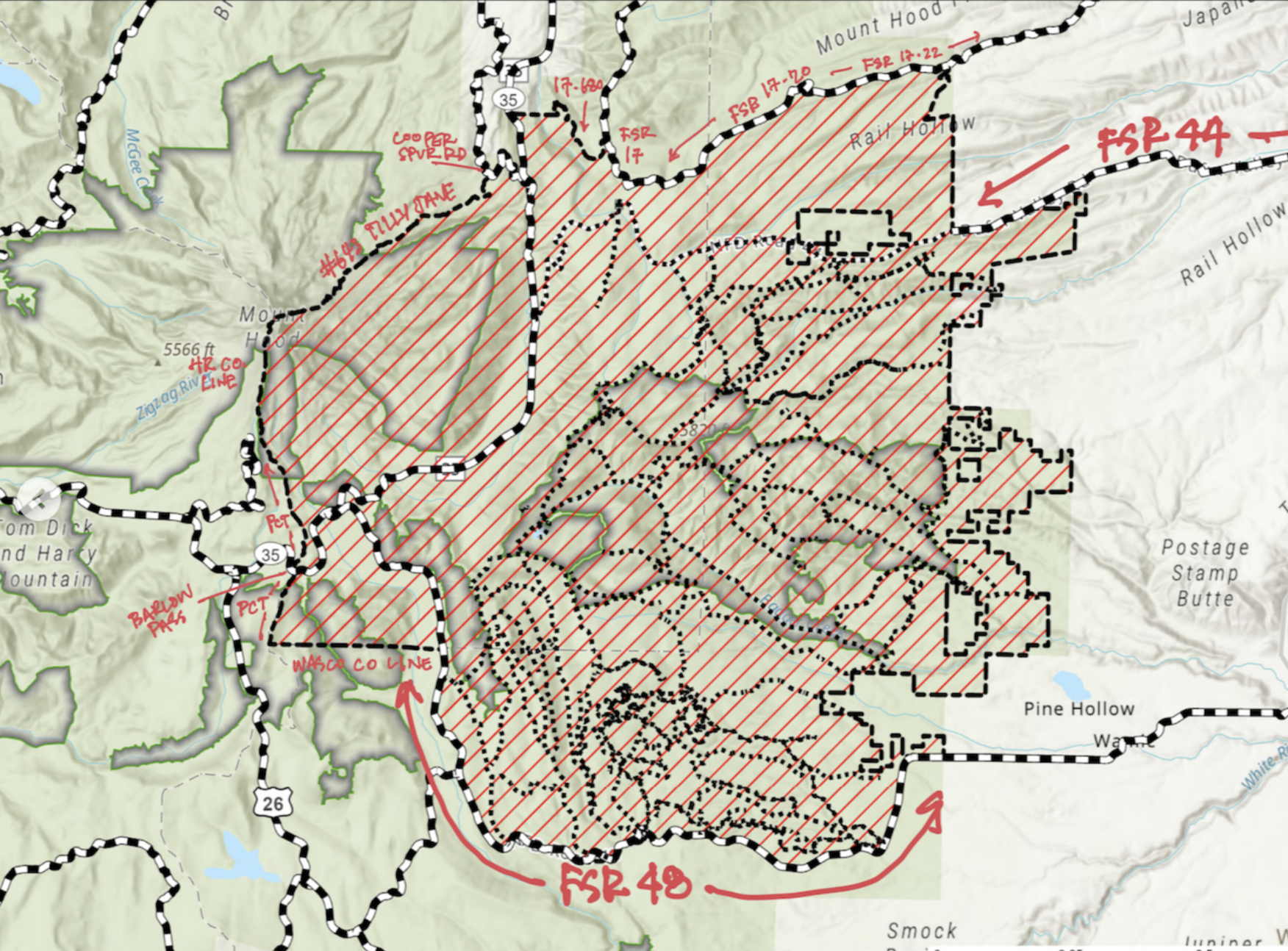
44 trails fire closure map

44Trails Forest Closure Map

First, thanks to all the firefighters and resources protecting people and property in our community.

Next, the 44 Trails network includes extensive closures due to the Grasshopper fire, and our planned Aug 16 work party is cancelled.

Please review the updated closure order from the Mt. Hood National Forest. The current forest closure expands on the original closure and is effective until 12/31/26 with the possibility of extensions.

It’s critical to follow closure orders to support firefighting efforts, We are in cotact with the Forest Service and will share information as the situation evolves. 

Fire Information Resources
USFS Closure Details
WatchDuty Grasshopper Fire
RideWithGPS (offers a fire perimeter map overlay on the trail system)
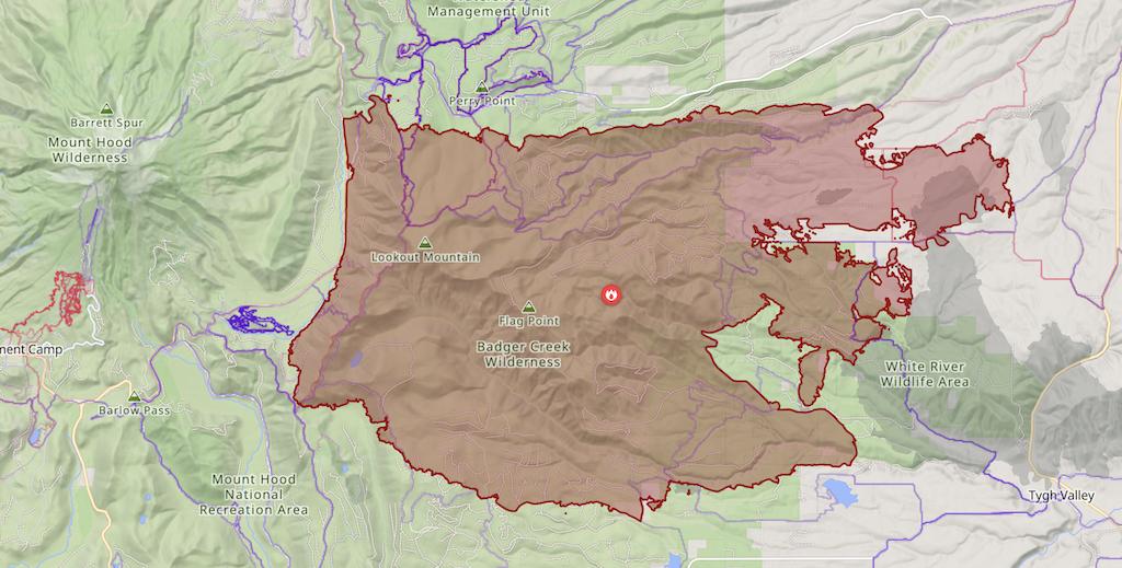
Grasshopper Fire Perimeter as of 8/15/26
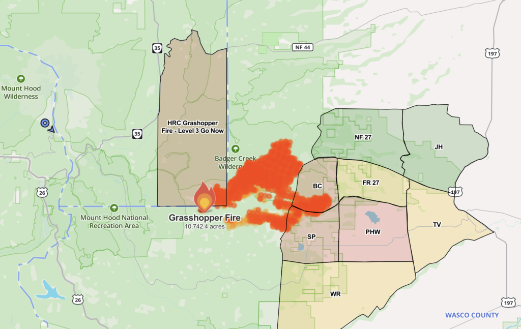
44 Trails Fire Closure

GrassshopperFireMapDATE: July 26, 2026
An active fire has much of the 44 Trails network under a level three evacuation, prompting the USFS to announce the closure of trails south of the 44 road.

Please respect all closures.
Fire updates are available on WatchDuty, and here is the latest USFS closure information

Trails included in closure

  • #450 Lookout  Mountain 
  • #456 Fifteen mile
  • #456A Fret Creek
  • #457 Cedar Creek 
  • #458 Divide
  • #460 Tygh Creek
  • #460A Tygh Creek Cut Away
  • #462 Jordan Cutoff
  • #463 Boulder Lake
  • #463A Little Boulder
  • #463B Boulder Lake Shore
  • #464 Crane Prairie
  • #467 Post Camp
  • #468 School Canyon
  • #469 Little Badger
  • #471 Bonney Meadows
  • #472 Hidden Meadows
  • #473 Forest Creek
  • #475 Rocky Butte
  • #477 Badger Creek Cutoff
  • #478 Boulder Creek
  • #479 Badger Creek
  • #480 Gunjuwac
  • #680 Jean Lake
  • #683 Underhill
  • #685 Gunsight Butte
  • #685 Camp Windy
 

Wy’East Wonder Trail Running Event

Wy'East Wonder Trail Running EventHeads up 44 Trails users!

The Wy’East Wonder trail running event will be on the trail system this weekend, June 28.

The race uses the Surveyors Ridge, Super Connector, Knebel Springs, Bottle Prairie, 8-Mile, Gunsight Ridge, Bennett Pass Road, and Oak Ridge trails. Please plan your trail use accordingly and yield to any race traffic!

See the race route and more info at www.GoBeyondRacing.com

Wyeast wonder notice

44 Trails Conditions 5/22/25

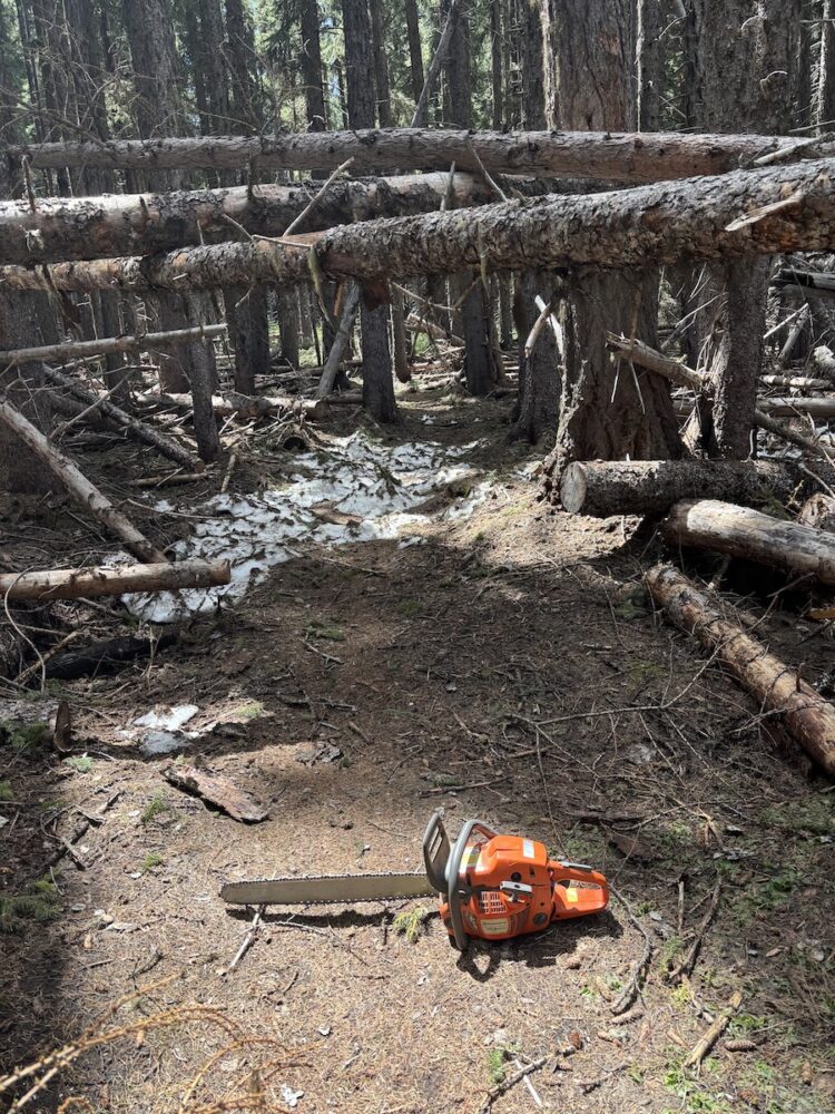
15 mile logoutUPDATE: More Trails Clear as of 5/22

Fifteen Mile Trail #456
Lookout Trail #450

Cedar Creek Trail #457 – about half clear — look for update soon!

Current full list of cleared trails:

Surveyors Ridge Trail #688
Super Connector / Hub Loop
North Section Line Trail #451 (still a bit brushy)
8-Mile Trail #496
Knebal Springs Trail #474
Bottle Prairie Trail #455
Lookout Trail #450
Fifteen Mile Trail #456

Check out the 44 Trails map on RideWithGPS

link to 44 trails on ridewithgps

Check out the 44 Trails map on Trail Forks

trail forks 44 trails map

Join our mailing list to learn about work parties
Or