44 Trails Meets Forest Leadership

Mount Hood National Forest

Forest Leadership Team

44 Trails Association participated in a congressional review of the Mt Hood National Forest with the USFS Forest Leadership Team for the Mt. Hood National Forest on May 30.

Our favorite corner of the Mt Hood National Forest (the 44 zone) plays an important role in the forest as it holds the watershed for The Dalles as well as the Dog River Pipeline, a vital component of the watershed. Additionally, ongoing fire mitigation thinning work, upcoming Dog River Pipeline upgrades and, of course, the importance of recreation were combined for a tour of the forest for congressional representatives, county representatives from Hood River and Wasco and the full regional Forest Leadership Team (FLT).

44 Trails was able to share stats on our ongoing work efforts to maintain, restore and enhance the multi-use trails accessible from FR 44. The FLT was very appreciative and supportive of our efforts, so we look forward to continued cooperation with the Barlow and Mt Hood districts to further our mission of trail maintenance and expansion!
Trail Conditions Update 5/23

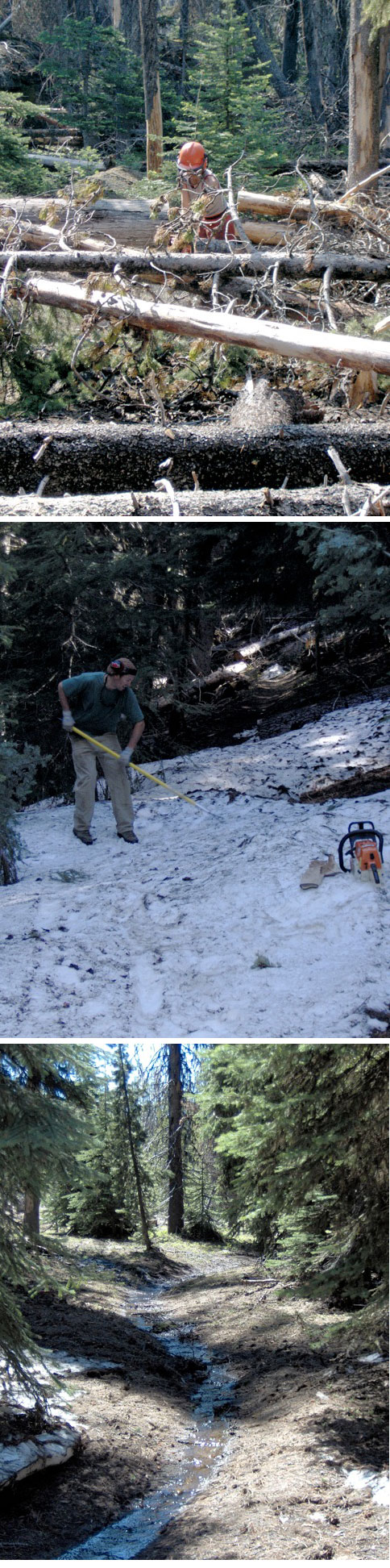
44 Trails AssociationThanks to the hard work of our favorite USFS Ranger, Jim Thornton, and some skilled 44 Trails Association volunteers (Paul Gundlach and Dana Hale!), 8-Mile trail, Knebal Springs trail, the Super Connector, Bottle Prairie trail and 15-Mile/Cedar creek are open to USFS spec and ready for riding! You’ll still encounter a few isolated single logs, but the big blow-down sections have been cleared!

As for High Prairie and 450 up higher, it’s still a no go. Too much snow and water on the tread (see photos). So please stay off the trails to avoid permanent tread damage.

You can also check out the Camas, Clear Creek, Rim Rock (connects at Clear Creek CG) and Bear Springs race course trails – all in the Barlow District on the east side.

Check the fed web site for beta on these trails. http://www.fs.usda.gov/recarea/mthood/null/recarea/?recid=52772&actid=34

Clear Creek trail

Camas Trail

If you’re keen to help with continued clearing efforts, reach out via e-mail to us and we’ll connect you with the ranger to make a plan.

New Two-Way Traffic Signs

New Yield to Uphill Traffic Signs

Yield to Uphill Traffic

Keep an eye out for the new two-way traffic signs up on the 44 trail system. 44 Trails Association helped pay for the new signs and they are being placed in high traffic areas on the trails.

The idea here is to yield to uphill traffic, so those of us who like to let ‘er rip down need to stay tuned in to other users, be they bikers, hikers or horse riders. Although we have some ideas (in the future) for downhill only development, all 44 area trails are currently open to two-way traffic.

Enjoy the spring weather!

Trail Conditions Update 5/19

Latest trail conditions update May 19:trail2

Knebal / Bottle Prairie – 75% clear of trees and tread dry – Hope to clear this week.

8-Mile – Good shape but there’s one big section of blowdown on streamside trail 20+ trees – hope to  clear this week.

High Prairie / 450 – Not ready. Snow on trails and tread too muddy for riding. 4410 road is also still closed due to snow. Please stick to lower trails.

15-Mile – Not ready. Needs clearing work. Hold use until after Memorial Day weekend, thanks.

Surveyor’s Ridge – Clear an ready to ride

Dog River – Clear and ready to ride