Dog River Trail Temp Closure

dog river trail closure map

Dog River Trail Temporarily Closed

Hood River County logging operations along Highway 35 are impacting Dog River Trail (#675) access. The trailhead and trail are closed for road relocation/construction during the logging operations. The estimated reopening time is July 2025.

The timber sale and related work are on neighboring Hood River County lands but still impact trail access. The construction work is intended to improve riparian areas and watershed quality.

Following the construction, access to the Dog River Trailhead will resume from a new location just north of the current trailhead entrance. Check Hood River County’s Trail Status page for more information.

In the meantime, Downhill MTB access will be allowed on Zig Zag Trail (#678) until access to Dog River is reopened.

visit the USFS Alerts and Notices page

Shuttle Day and Hidden Meadows Trail Work – 10/26-27

fall-work-day

Heads up 44 riders. We have a full weekend of 44 Trails events coming your way on October 26-27.

FUNDRAISER SHUTTLE RIDE DAY – Oct 26, 2024 
9am-3pm @ Eightmile Campground

Join us on October 26th for our first-ever shuttle ride fundraising event! We’re partnering with Oregon Territory Outfitters, Fat Tire Farm, the USFS, and Loam Coffee Roasters for a weekend of free mountain bike shuttles. A donation to 44T is greatly appreciated.

Shuttle Day Details

TRAIL WORK DAY – Oct 27, 2024 
Hidden Meadows to Cane Creek connector trail

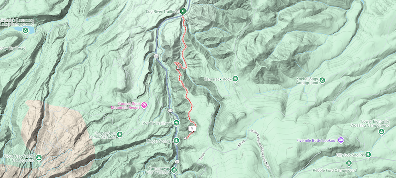
Join 44 Trails for a trail work day at Hidden Meadows Trail (south) #472 in the Boulder Lakes network.

There will be lunch for everyone, thanks to NY City Subs in Hood River.

WHEN: Sunday, October 27th, 9 am

WHERE: Meet at White River East Sno-Park at the intersection of Hwy 35 and FS48.  We will caravan down to the work spot at the end of Hidden Meadows (#472).

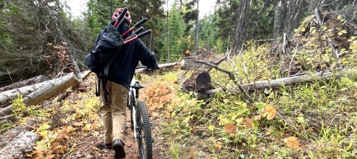
SCOPE OF WORK: We are building an extension trail from the south end of Hidden Meadows to connect with Crane Creek Trail to exclude the road. If you haven’t ridden this gem of a network, come get familiar.

With a shortened maintenance season the last few years (late snow melt and early fire restrictions), we recognize that maintenance has piled up and are working on getting as much done as we can before the snow flies so it is a more rideable network next year. FYI, Hidden Meadows is now cleared and rideable.

WHAT: Building an extension trail from Hidden Meadows to connect with Crane Creek.

REQUIRED: Long pants, work boots, gloves, day pack, water, snacks, bike helmet, eye protection. Bring dirt-digging tools if you have ‘em.

Follow the 44 Trails Association on Instagram

44 Trails Conditions Update 7/1/24

the view from the bars - cooks meadows44 Trails Conditions Update

More trails cleared for riding!

The following trails are clear and ready to ride:

Newly cleared:
Upper 450
Upper Cooks
Gunsight Ridge

Previously cleared:
Fifteenmile
Cedar Creek
Underhill
Dog River Trail
Surveyor’s Ridge Trail
The Hub Trail
The Super and Super Duper Connector Trails
Eightmile
Knebal
Bottle Prairie
Cooks Meadow (from 44 to 650 road)
Lookout (from 44 to 4420)

Yet to be cleared:
– There’s still a little snow (1/2 mile section) on Gunsight (as of 6/30)
– The more remote backcountry zones, including Boulder, Crane Creek, Hidden Meadows and Forest Creek, have yet to be cleared

Check out the full 44 Trails system map on RideWithGPS

44 Trails Conditions Update 6/7/24

44 Trails conditions update

44 Trails conditions update – 6/7/24

More 44 Trails cleared for riding!

The following 44 trails are clear and ready to ride:

Newly cleared:
Fifteenmile
Cedar Creek
Underhill

Previously cleared:
Dog River Trail
Surveyor’s Ridge Trail
The Hub Trail
The Super and Super Duper Connector Trails
Eightmile
Knebal
Bottle Prairie
Cooks Meadow from 44 to 650 road)
Lookout (from 44 to 4420)

Yet to be cleared:
– Upper 450 (Lookout) still has snow (and trees yet to be cleared) above the junction to Fifteenmile
– Other high-elevation zones, including Gunsight, Boulder, Crane Creek, Hidden Meadows and Forest Creek

Happy riding!

Check out the RWGPS map of the 44 Trail system