44 Trails Conditions Update – May 26, 2023
Dog River Trail #675 is clear. Thank you Fat Tire Farm crew!
Please note the Dog River Super-D is being run on Dog River Sunday, May 28.
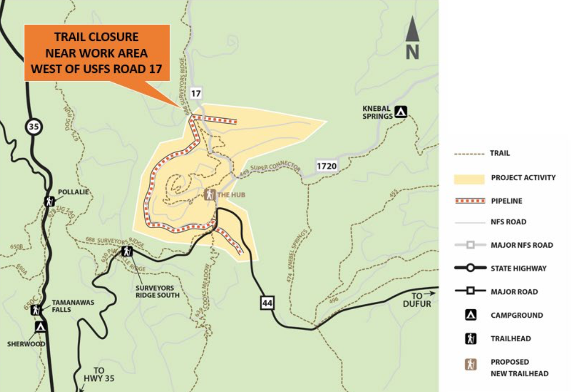
Surveyor’s Ridge Trail #688 is clear from the Bald Butte saddle to the intersection of Cooks Meadow Trail #639. But Cooks Meadow is still under snow beyond the intersection with Surveyor’s. (see pic).
Continuing from Surveyor’s, Thunder Road and the Super Duper Connector are also clear and rideable. Expect trees and snow elsewhere on the system.