Fire Closure – Mt Hood National Forest

Badger Lake fire mt hoodIf you have not heard, there is a fire near Badger Lake on the Barlow District of the Mt Hood National Forest.

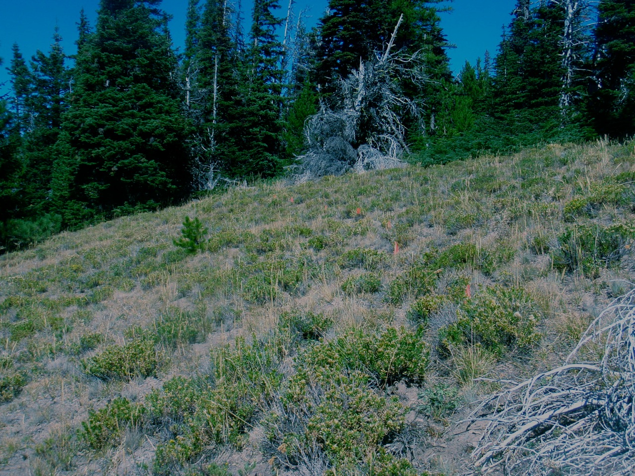
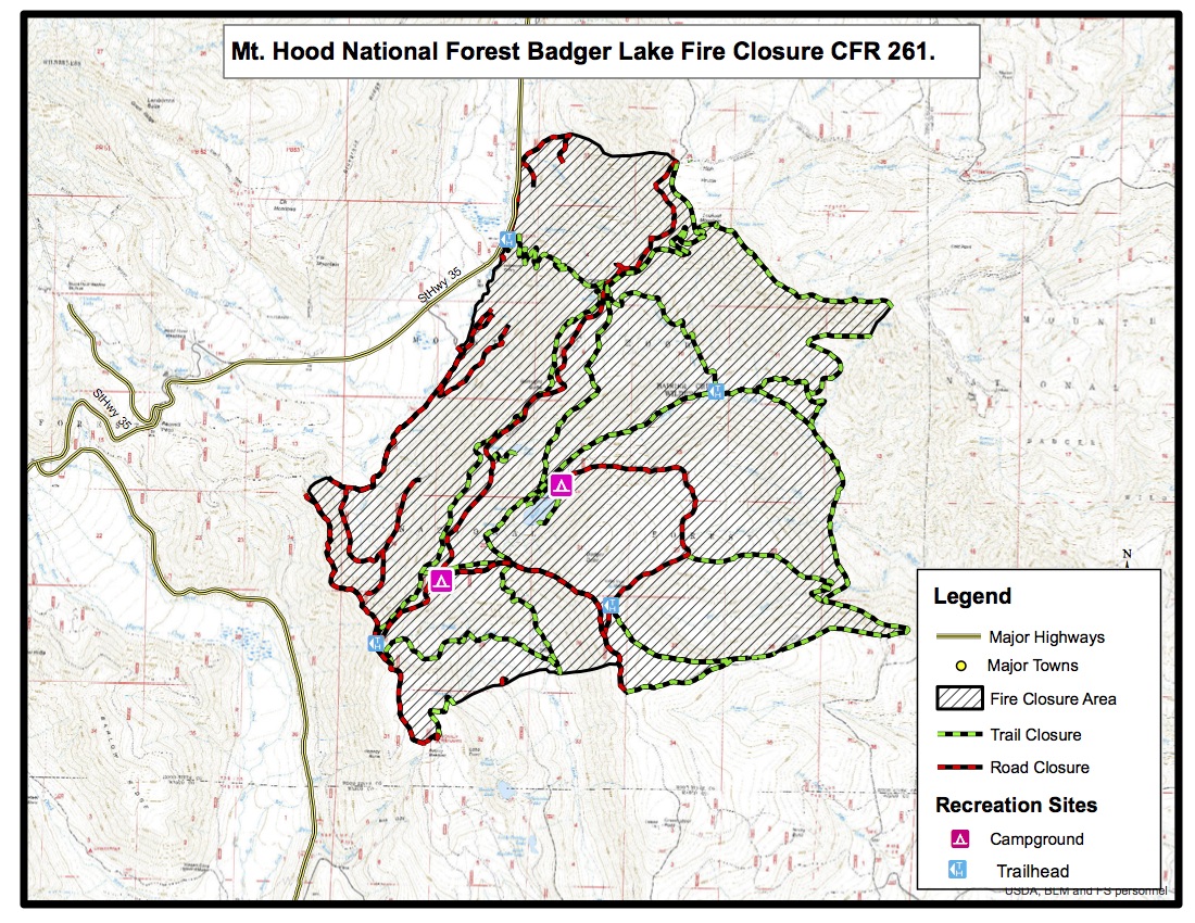
It’s not directly affecting the bulk of the 44 Trails zone, but there are a number of closures to consider if you are headed up to the area, most notably High Prairie, Gumjuwac, Gunsight and most everything adjacent to Badger lake including the Boulder Lake.

Badger lake Fire mapHere’s the latest official info from the USFS. 

Media Information Line: 503-668-1791/503-668-1776
Public Fire Information: (541) 467-2291
Office hours: 8:00 a.m. to 4:30 p.m.

10/6/15 UPDATE:

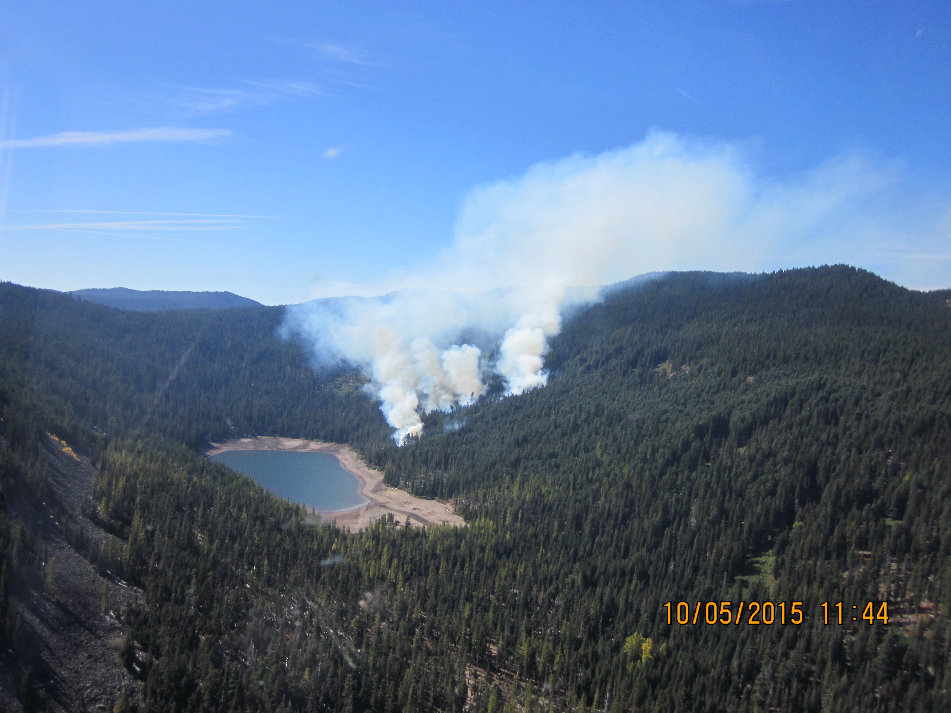
The Badger Lake Fire is approximately 60 acres in size and burning in heavy dead and down timber. The fire is located northwest of Badger Lake in the Badger Lake Wilderness. Steep terrain, limited road access and an abundance of snags (standing dead trees) pose challenges for firefighter safety. Retardant was dropped on Forest Road 3550 yesterday with the goal of keeping the fire within the wilderness. Additional retardant has been ordered. Two helicopters continue to work on the fire.

The Badger Lake Fire began on Saturday, October 3, 2015. The cause of the fire is under investigation. Base Camp for the Fire is at Badger Lake Campground.

An area closure is in effect for the area surrounding the fire to protect public and firefighter safety as crews work to contain the fire. The closure includes roads, trails and developed recreation sites. Please contact the Barlow Ranger Station for details or the website address below.

PERSONNEL AND RESOURCES: Approximately 70 personnel, including 2 20 person crews, 4 Type 6 Engines, 1 Type 1 helicopter, and 1 Type 2 helicopter, and 12 rappellers.

SPECIAL MESSAGES/CLOSURES: An area closure is in effect for the Badger Lake Fire. For more information on the closure go to the Mt. Hood NF Closure webpage.

Badger Lake Fire Closure
Effected roads:

  • 3500640 Closed
  • 3500641 Closed
  • 3500642 Closed
  • 3500660 Closed
  • 3540000 Closed
  • 3540011 Closed
  • 3540012 Closed
  • 3540630 Closed
  • 3540640 Closed
  • 3540641 Closed
  • 3550000 Closed
  • 3550620 Closed
  • 4860000 Closed
  • 4860140 Closed
  • 4860160 Closed
  • 4880000 Closed
  • 4891000 Closed
  • 4891120 Closed

Effected Trails:

  • 465         PINE CREEK Closed
  • 477         BADGER CREEK CUTOFF Portion Closed
  • 458         DIVIDE Closed
  • 478         CRANE CREEK Portion Closed – North End
  • 464         CRANE PRAIRIE Portion Closed
  • 466         THREE MILE Closed
  • 479A      BADGER LAKE Closed
  • 480         GUMJUWAC Closed
  • 680         JEAN LAKE Closed
  • 467         POST CAMP Closed
  • 477A      WEST FORK Closed
  • 685B      CAMP WINDY Closed
  • 463         BOULDER LAKE Portion Closed
  • 493         HIGH PRAIRIE Closed
  • 685         GUNSIGHT BUTTE Closed
  • 479         BADGER CREEK Portion Closed (West of Bonney Crossing)

Effected Rec Sites are

  • Badger Lake C.G. Closed
  • Camp Windy C.G Closed
  • Bonney Meadows Closed

Cooks Meadow Trail Project

2015 trail work scheduleWe got the go ahead from the USFS and we’re ready to get to work on the Cooks Meadow Extension project!

All trail days are rain or shine. Please dress for the weather. Hand tools, drinking water, HELMETS (required – bike helmets ok), gloves and work shoes recommended. We’ll post a few more details on what to bring the week before the trail day.

Want to more about the trail? check out the map

Here is our fall 2015 work schedule:

Sunday, November 1, 2015
DETAILS: Meet 9am at Little John SnoPark on Highway 35
PROJECT: Early stage tread work. lopping, brushing of pin line

Saturday, November 21, 2015
DETAILS: Meet 9am at Little John SnoPark on Highway 35
PROJECT: Early stage tread work. lopping, brushing of pin line

Saturday, December 5, 2015
DETAILS: Meet 9am at Little John SnoPark on Highway 35
PROJECT: Early stage tread work. lopping, brushing of pin line

Cooks Meadow Extension Approved

view of mt hood from cooks meadow extension trail

view of mt hood from cooks meadow extension

Well, it took a little longer than we were hoping, but the Hood River Ranger District just approved the proposed Cooks Meadow Extension Trail that we have been hoping to begin work on this fall.

44 Trails Association would like to thank all who commented and added their support  during the public process for the new trail.

cooks meadow extension map

map of area

The new trail will move the route off of the 4410 road and create approximately four miles of new single track! A short section (2/10 of a mile) at the very top, which crossed the High Prairie Meadow, was adjusted based on public comment. Although it would have been nice to roll through the meadow, we can live with 2/10 of a mile on the road to connect to the parking lot.

You can read the full Cooks Meadow decision document from the district ranger here.

We will announcing our work party schedule before the end of September and hope to hold at least one trail work day this October. Stay tuned for details or sign up for our e-mail list to be notified automatically.

Once completed, the Cooks Meadow extension will connect the lower Cooks Meadow trail with High Prairie and the 450 trail, creating a new loop ride and further working toward our goal of an interconnected trail system worthy of destination riding on the Mt Hood National Forest.

44 Trails Map

44 trails mapWe recently completed a digital map of the 44 Trails area that is designed for use on your mobile device. The geo-referenced PDF is viewed with the free Avenza PDF Map App (available for iPhone, Android and Windows phones). The map shows your location, offers your coordinates and allows you to navigate.

At this point, we’ll call it a beta version of the map, as we have not been able to check every trail. Think of it as a good general reference.

You can get your free copy of the map by signing up for our e-mail list. Once you sign up, you’ll get an e-mail that includes a download link for the map.

How to get the free 44 Trails Mobile Map:

1. Download the Avenza Map App (free) on your mobile device.
2. Sign up for our mailing list and a link to download the 44 Trails map will be sent to you.
3. Open 44 Trails map with Avenza on your device

The map is for general reference only and is provided without a warranty of any kind, either expressed or implied. Use of this map is at your own risk and discretion.

Sign up for our mailing list to receive the 44 Trails Map for free!